Walk Austin and pull back the fog
In FOG the world starts hidden and only your own walking reveals it. Austin has a small walkable core, a superb river loop, and a lot of hot sprawl beyond that.
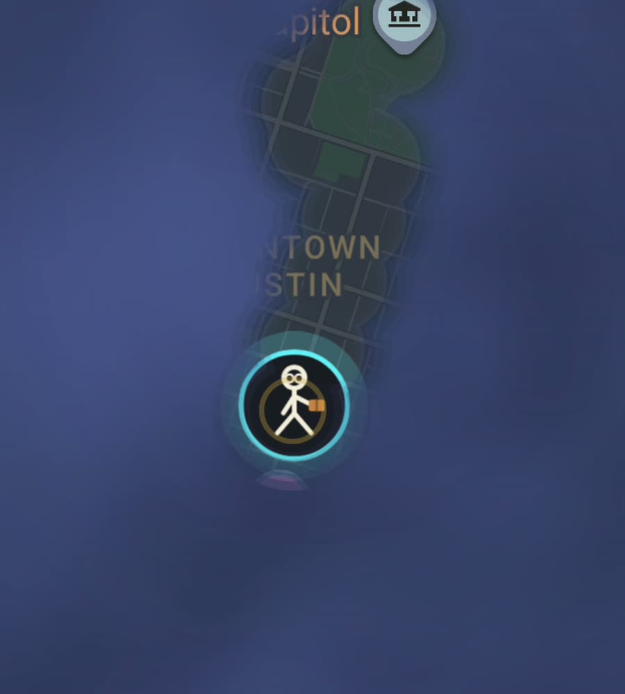
Austin on the FOG map, with fog cleared along a route walked through downtown and along the river.
A small grid with a river through it
Downtown Austin is a straightforward numbered grid on the north bank of Lady Bird Lake, with Congress Avenue as the axis running up to the Capitol. It is compact and flat and covers quickly. North of the Capitol the University of Texas campus adds another walkable block. East of I-35 the grid continues into East Austin, which has been rebuilt heavily but is still walkable street by street.
South of the river things change. South Congress and South First run as long commercial strips, walkable in a line but with limited cross-connections. Beyond the central few miles, Austin is a car city on rolling Hill Country terrain, with subdivisions, big arterials and stretches with no sidewalk at all. The hills start in earnest to the west, around Zilker, Barton Hills and Tarrytown, and they are steeper than most people expect from a Texas city.
The route that makes the map look good
The Ann and Roy Butler Hike and Bike Trail circles Lady Bird Lake, roughly ten miles for the full loop with the Longhorn Dam and Pfluger bridges closing the ends. It is continuous, shaded in long stretches, and it draws a clean closed ring on the map, which is a genuinely satisfying thing to complete in one go.
A better version for clearing area: walk the northern half of the loop from Zilker Park east to the Congress Avenue bridge, then leave the trail and go up Congress to the Capitol, cutting east and west across the downtown grid as you go. Come back down through the Rainey Street area, rejoin the trail and finish along the south bank through South Congress. That gets you the ring, the grid and two commercial spines in about four hours.
Heat, sprawl, and what the numbers mean
Austin summers are the constraint and there is no way around them. From June to September, afternoons sit in the high thirties Celsius and there are long runs of days over forty. Walking at two in the afternoon in August is a bad idea. The realistic walking season is October through May, plus early mornings the rest of the year. Winter is mild and mostly excellent for this.
The other constraint is sprawl. The metro runs a very long way north up the I-35 corridor and south past Slaughter Lane, and those areas are built at a scale that only makes sense in a car. Walking there reveals a line and not much else. FOG shows the percentage of a city you have lit, and in Austin the number rises fast while you work the central few square miles and then flattens hard.
Downtown's newer towers along Congress and around Rainey Street form a small canyon that can nudge GPS off by a block. It is a limited area and it corrects itself quickly, but you may see one odd-looking line through the middle of a building.
The app side of it
FOG runs with the app closed and the screen off, which is what you want on a hot ten mile loop. There is no account, no sign-up, no cloud, no app analytics, no ads and no tracking. The map never leaves your phone, and you can export your data.
Exploring is free. A single purchase of USD 5.99 unlocks unlimited ranks, every character and history import, permanently, with no subscription. History import reads Google Timeline exports and GPX files, so the years of laps around Lady Bird Lake you already recorded can be painted straight onto the map.
Ranks climb with the area you have covered: Wanderer, Scout, Pathfinder, Explorer, Voyager. There is also a collection of 241 countries, 3,390 regions and 7,342 named places, and the only way to add to it is to physically stand in the place.
Questions people actually ask
Is Austin walkable?
The downtown grid, the university, East Austin and the river trail are. Past that it is a car city with rolling hills and patchy sidewalks.
How long is the Lady Bird Lake loop?
About ten miles for the full circuit. Shorter loops are possible using the Pfluger or Lamar bridges.
When should I not walk?
Summer afternoons. June through September regularly brings high thirties and above. Walk at dawn or wait for autumn.
Does FOG work for running and cycling too?
Yes. It works for walking, running and riding, anywhere on Earth, and reveals the map the same way.
Is there a subscription or ongoing cost?
No. Exploring is free and one purchase of USD 5.99 unlocks unlimited ranks, every character and history import. There is never a subscription.
Start with a dark map.
FOG is free to explore. No account, no subscription, and your map never leaves your phone.
free to explore · one purchase unlocks everything · never a subscription