Walk Bangkok and burn the fog off it
FOG covers the world in fog and only clears what you have walked yourself. Bangkok is flat, hot, and built out of dead-end lanes, so the shape it leaves is unlike anywhere else.
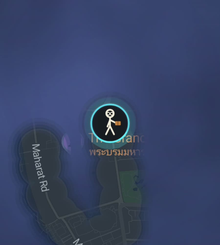
Bangkok on the FOG map, fog cleared along a walked route from the old royal island into Chinatown.
Flat ground, hard air
Bangkok has no hills. None. It is delta silt on both sides of the Chao Phraya, and the only climbs you will do are bridge ramps and the stairs up to the BTS skywalks. That should make it easy walking, and the terrain does its part.
The air does not. It runs around 33C with humidity that makes the number feel optional, and the hot season from March to May is genuinely punishing. From roughly June to October the afternoon rain arrives hard and briefly floods low streets. The practical answer is what everyone here already does: walk early, walk late, and use the middle of the day for shade, river boats and air conditioning. A six kilometre walk at seven in the morning is pleasant. The same walk at two in the afternoon is a decision you will regret.
The soi problem
Bangkok's street grammar is a small number of large roads with numbered side lanes, sois, hanging off them. Sukhumvit is the clearest example: odd numbers on one side, even on the other, running for kilometres. Some sois punch straight through to the next main road. Many stop dead at a wall, a temple, a canal or a condominium gate.
You cannot tell which from the map, and that shapes the fog. Walk a district thoroughly and the cleared area comes out looking like a comb: a long spine of main road with teeth of varying length sticking off it, some joined at the far end, most not. Finishing a soi means walking it twice, in and out. That is the honest cost of a complete looking map here.
The old core is different. Rattanakosin, the royal island, and Banglamphu next to it are a tighter, older network around Sanam Luang and the temples, and they fill in like an actual old town. Chinatown around Yaowarat Road is denser still, a mat of narrow market lanes off one long spine.
An afternoon corridor
Start at Wat Pho. Walk north along Maharaj Road past the Grand Palace and Sanam Luang, then turn back down through Tha Tien and follow the river south past Pak Khlong Talat, the flower market, which is worth the detour at any hour. Cross Chakkraphet Road into Chinatown and walk the length of Yaowarat, ducking into Soi Nana or the lanes toward Talat Noi when they open up. Finish near Hua Lamphong station.
That is about seven kilometres, flat, and it lights up the densest and oldest ground in the city in one line. If you want the modern counterpart, do Lumphini Park at dawn, then Silom from end to end down to the river at Saphan Taksin.
Fog, GPS and honest expectations
Bangkok is enormous and low-rise for most of its footprint, so the city percentage climbs slowly no matter how much you walk. The satisfying move is to take one district at a time. Ari, Thonglor, Banglamphu and Talat Noi are all small enough to be genuinely worked through.
One practical note. In the high-rise canyons along Sukhumvit, Silom and Sathorn, and up on the raised BTS walkways, the signal bounces off glass and the trace can wander a little. It settles once you are back on open street. Everywhere else the map draws clean.
FOG keeps revealing with the app closed and the screen off, which matters here because you will not be holding a phone in that heat. Every district you stand in counts toward 241 countries, 3,390 regions and 7,342 named places, all of them collected only by physically being there. No account, no cloud, no ads, no tracking.
Questions people actually ask
When is Bangkok bearable on foot?
Early morning and after dark most of the year. The cool season from November to February is the only stretch where a long midday walk is realistic.
Do the raised walkways get recorded?
Yes, they are ground you walked. In tight high-rise stretches the trace can wander slightly before settling, which is a property of the buildings rather than the app.
Does it work with the app closed?
Yes. Background exploring keeps revealing streets with the app closed and the screen off.
What does the unlock cost?
Free to explore. One purchase of USD 5.99 unlocks unlimited ranks, every character and history import. There is no subscription.
Can I import old trips to Bangkok?
Yes, with the paid unlock. FOG imports Google Timeline exports and GPX files, so previous visits can be burned into the map.
Start with a dark map.
FOG is free to explore. No account, no subscription, and your map never leaves your phone.
free to explore · one purchase unlocks everything · never a subscription