Walking Cairo, and the fog it takes off
FOG covers the entire world map until your feet uncover it. Cairo is one of the largest cities on Earth, so the fog comes off in pockets rather than sheets.
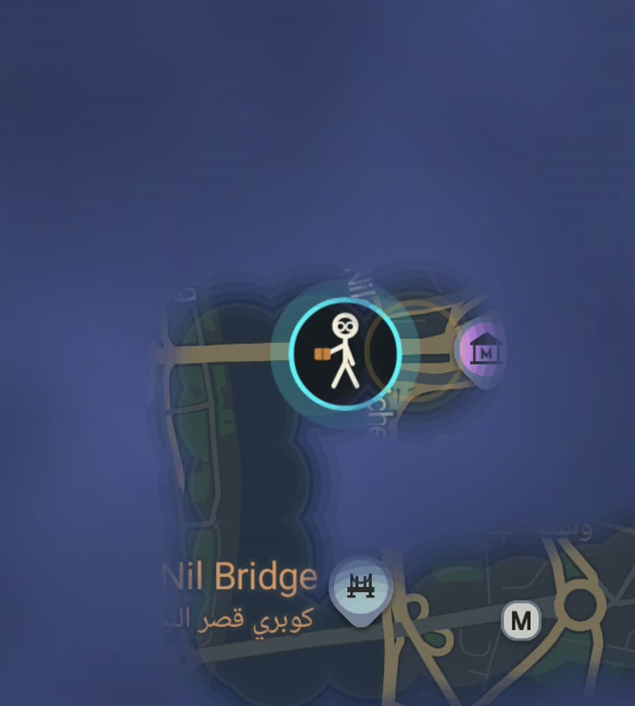
Cairo in FOG, with the fog cleared along a walked route through the medieval streets and out to the Nile corniche.
Flat ground, enormous scale
Cairo is flat. Apart from the Mokattam escarpment on the eastern edge and the low ridge under the Citadel, the whole city sits on river plain, so nothing here will tire your legs the way the traffic and the air will. Greater Cairo holds more than twenty million people spread across a very large area, and that is the number that matters for a fog map. Your city percent is going to move in small increments for a long time.
The Nile splits it, with Zamalek and Roda sitting mid river as islands and Giza on the west bank. The bridges are walkable, the Qasr al-Nil bridge especially, though the corniche traffic running beside them is fast and constant.
The medieval core is the good part
Historic Cairo is where walking pays off properly. The streets between Bab Zuweila and Bab al-Futuh are medieval, narrow and continuous, with al-Muizz li-Din Allah running the length of them. Khan el-Khalili spills off it into a lattice of covered lanes. None of it is on a grid, most of it is too tight for cars, and the density of separate streets per square kilometre is enormous.
Downtown, the Khedivial quarter around Talaat Harb square, is a completely different plan: nineteenth century European boulevards radiating out of circular squares. Coptic Cairo down at Mar Girgis is a small walled pocket you can cover in an hour. Garden City curves on purpose, and it will get you lost.
An afternoon from Tahrir
From Midan Tahrir, walk the Qasr al-Nil bridge with the lions at the end of it, loop the southern half of Zamalek, then come back and work east through Downtown toward Ataba. If you still have legs, carry on to al-Azhar and enter the old city there. That is a long day, and it crosses three completely different eras of city planning.
The shorter, denser version: start at Bab Zuweila and walk north up al-Muizz to Bab al-Futuh, threading every side lane you can on the way. A kilometre and a half of main street, and several kilometres of alleys hanging off it.
Heat decides the season
The honest limit here is heat. From May through September the afternoons sit around forty degrees, and walking any real distance in the middle of the day is a bad idea rather than a challenge. The walking season is roughly November to March, and even then the early morning is the good window. Dust and traffic fumes are constant.
Crossing the street is its own skill. Signals are sparse, you cross in the gaps, and you do not run. The Metro is genuinely useful for jumping between walkable pockets that sit five kilometres apart.
What FOG records
FOG hides the world map and reveals only what you have physically walked. It runs with no account, no sign-up, no cloud and no tracking, and nothing about your route leaves the phone. You can export your own data if you want it somewhere else.
Background exploring keeps the reveal running with the app closed, which is useful on a long day when you are not going to keep a screen on in the sun. Free to explore. One purchase of USD 5.99 unlocks unlimited ranks, every character, and history import from Google Timeline exports and GPX files, which is the fastest way to fill in walks you already did.
Questions people actually ask
When is Cairo actually walkable?
Roughly November to March, and early morning even then. Afternoon heat from May to September makes long distances genuinely unwise.
Does FOG include anything about Cairo's sites?
No. There are no guides, no curated routes and no city-specific features. The map is the same everywhere and only the streets differ.
Can I take the Metro between areas without ruining my map?
FOG reveals what you physically cover. A Metro hop simply does not clear the streets above it, so the pockets you walk stay separate on the map.
How do I add old trips?
History import comes with the one-off USD 5.99 unlock and reads Google Timeline exports and GPX files.
Start with a dark map.
FOG is free to explore. No account, no subscription, and your map never leaves your phone.
free to explore · one purchase unlocks everything · never a subscription